Log in
All resources
Create a design
5,255 Free Images of Fauna Bl
british library
copper engraving print
joan blaeu
harvard university
ernst mayr library
1667 maps
museum of comparative zoology
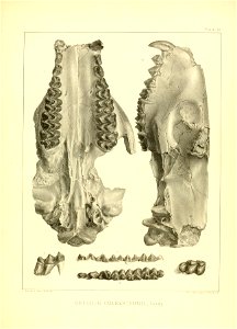
limestone fauna
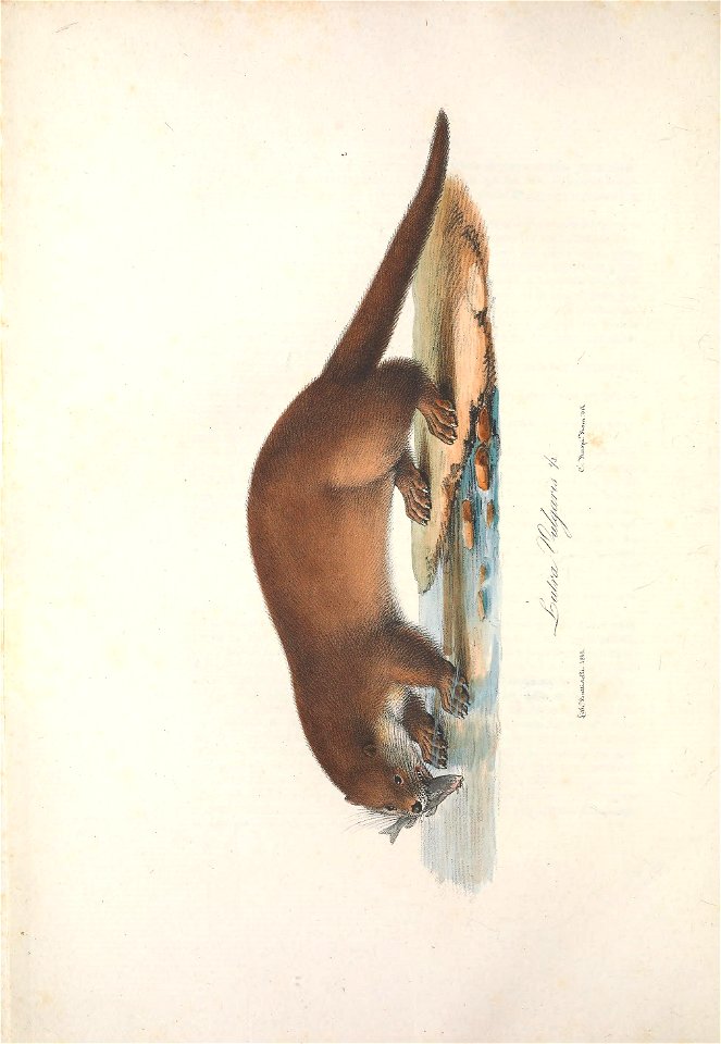
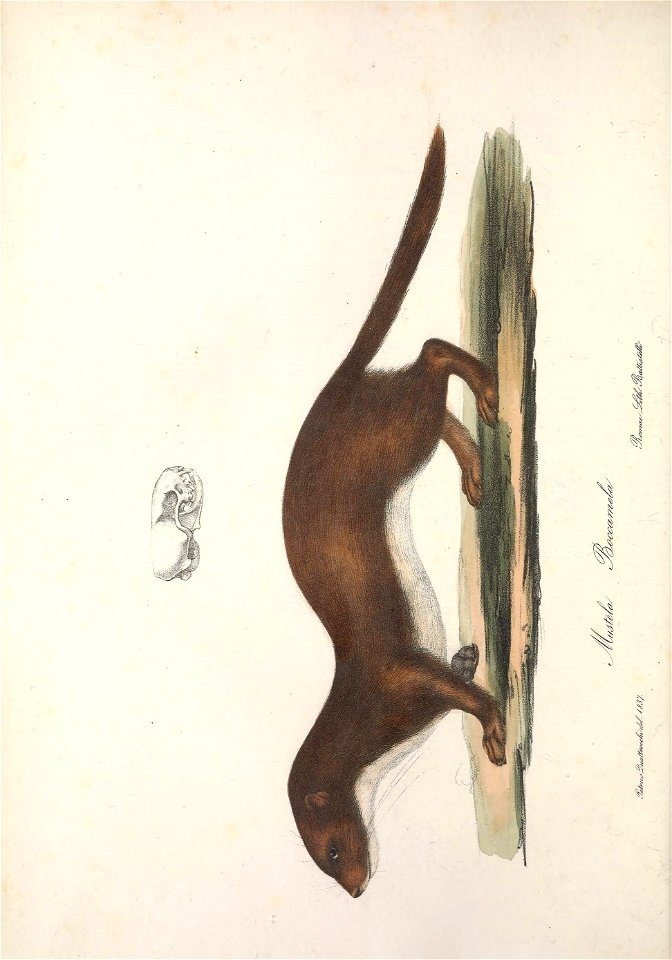
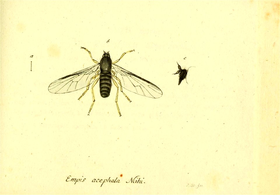
annales du musée royal d'histoire naturelle de belgique t.8:pt.4 (1883)
atlas maior, vol 5 (england) - joan blaeu, 1667 - bl 114.h(star).5
harvard university
ernst mayr library
harvard university
ernst mayr library
harvard university
ernst mayr library
harvard university
ernst mayr library
harvard university
ernst mayr library
animals
italy
harvard university
ernst mayr library
harvard university
ernst mayr library
animals
italy
animals
italy
harvard university
ernst mayr library
harvard university
ernst mayr library
harvard university
ernst mayr library
harvard university
ernst mayr library
animals
italy
animals
italy
animals
italy
harvard university
ernst mayr library
harvard university
ernst mayr library
harvard university
ernst mayr library
animals
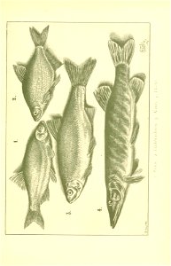
fish
identification
fish
identification
fish
identification
fish
identification
fish
identification
fish
library
germany
ornament
plants
ornament
plants
flower
period
ornament
plants
mammals
fossil
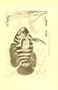
aquarium
fish
aquarium
fish
library
germany
library
germany
library
germany
zoology
canada
atlas maior, vol 11 (asia) - joan blaeu, 1667 - bl 114.h(star).11
1667 maps
the county seats of the noblemen and gentlemen of great britain and ireland by francis orpen morris - bl copy
country houses in worcestershire
the county seats of the noblemen and gentlemen of great britain and ireland by francis orpen morris - bl copy
workington hall
atlas maior, vol 11 (asia) - joan blaeu, 1667 - bl 114.h(star).11
1667 maps
imperial war museum first world war artwork
paintings of world war i by john lavery
old and new london, illustrated (1873) by walter thornbury and edward walford - bl 1887 copy
moritz klinkicht
coats of arms of hugh x of lusignan, count of la marche and angoulême
historia anglorum (1250-1259) - bl royal ms 14 c vii
historia anglorum (1250-1259) - bl royal ms 14 c vii
depictions of matthew paris
17th-century maps of south america
maps by nicolas sanson
old and new london, illustrated (1873) by walter thornbury and edward walford - bl 1887 copy
john thomas smith (1766-1833)
old and new london, illustrated (1873) by walter thornbury and edward walford - bl 1887 copy
the antiquities of england and wales (1772)
carmina regia (c.1335-1340) - bl royal ms 6 e ix
miniatures of knights on horses
carmina regia (c.1335-1340) - bl royal ms 6 e ix
miniatures of knights on horses
historia anglorum (1250-1259) - bl royal ms 14 c vii
representation of reading abbey in works of art
the county seats of the noblemen and gentlemen of great britain and ireland by francis orpen morris - bl copy
worsley new hall
tilliot hours (c.1500) - bl yates thompson ms 5
medieval miniatures of devils
lord burghley's atlas (1579) - bl royal ms 18 d iii
maps of wales by humphrey llwyd
historia anglorum (1250-1259) - bl royal ms 14 c vii
maps by matthew paris
matthew paris, abbreuiatio chronicorum, ad 1000–1255 (13th c) - bl cotton ms claudius d vi
henry ii of england in miniatures
the county seats of the noblemen and gentlemen of great britain and ireland by francis orpen morris - bl copy
blandford st mary
atlas maior, vol 6 (scotland and ireland) - joan blaeu, 1667 - bl 114.h(star).6
1667 maps
old and new london, illustrated (1873) by walter thornbury and edward walford - bl 1887 copy
joseph swain
the county seats of the noblemen and gentlemen of great britain and ireland by francis orpen morris - bl copy
audley end house in art
the county seats of the noblemen and gentlemen of great britain and ireland by francis orpen morris - bl copy
st michael's mount in art
the county seats of the noblemen and gentlemen of great britain and ireland by francis orpen morris - bl copy
west wycombe park in art
the county seats of the noblemen and gentlemen of great britain and ireland by francis orpen morris - bl copy
windsor castle from the river
the county seats of the noblemen and gentlemen of great britain and ireland by francis orpen morris - bl copy
historic prints of hatfield house
the becket leaves (c.1220-1240) - bl loan ms 88
medieval miniatures of horses
medieval miniatures of gardens
ghent-bruges school
the county seats of the noblemen and gentlemen of great britain and ireland by francis orpen morris - bl copy
picton castle in art
atlas maior, vol 5 (england) - joan blaeu, 1667 - bl 114.h(star).5
17th-century maps of the isle of wight
old and new london, illustrated (1873) by walter thornbury and edward walford - bl 1887 copy
john walmsley
atlas maior, vol 6 (scotland and ireland) - joan blaeu, 1667 - bl 114.h(star).6
maps of idrone by gerardus mercator
atlas maior, vol 1 (northern europe, norway, and denmark) - joan blaeu, 1667 - bl 114.h(star).1
1660s maps of norway
atlas maior, vol 5 (england) - joan blaeu, 1667 - bl 114.h(star).5
17th-century maps of the isle of man
atlas maior, vol 1 (northern europe, norway, and denmark) - joan blaeu, 1667 - bl 114.h(star).1
1667 maps of europe
victorian architecture
horace nicholls
victorian architecture
horace nicholls
victorian architecture
horace nicholls
1660s maps of spain
1667 maps
1660s maps of spain
1667 maps
1660s maps of spain
1667 maps
atlas maior, vol 5 (england) - joan blaeu, 1667 - bl 114.h(star).5
1667 maps
victorian architecture
horace nicholls
1660s maps of spain
1667 maps
1660s maps of spain
1667 maps
atlas maior, vol 6 (scotland and ireland) - joan blaeu, 1667 - bl 114.h(star).6
1667 maps
1660s maps of spain
1667 maps
1660s maps of spain
1667 maps
1660s maps of spain
1667 maps
atlas maior, vol 3 (germany) - joan blaeu, 1667 - bl 114.h(star).3
johannes gigas
1660s maps of spain
1667 maps
atlas maior, vol 11 (asia) - joan blaeu, 1667 - bl 114.h(star).11
1667 maps
atlas maior, vol 5 (england) - joan blaeu, 1667 - bl 114.h(star).5
17th-century maps of leicestershire
atlas maior, vol 5 (england) - joan blaeu, 1667 - bl 114.h(star).5
17th-century maps of gloucestershire
atlas maior, vol 5 (england) - joan blaeu, 1667 - bl 114.h(star).5
17th-century maps of glamorgan
atlas maior, vol 5 (england) - joan blaeu, 1667 - bl 114.h(star).5
17th-century maps of staffordshire
atlas maior, vol 5 (england) - joan blaeu, 1667 - bl 114.h(star).5
17th-century maps of hampshire
atlas maior, vol 5 (england) - joan blaeu, 1667 - bl 114.h(star).5
17th-century maps of yorkshire
atlas maior, vol 5 (england) - joan blaeu, 1667 - bl 114.h(star).5
17th-century maps of wiltshire
atlas maior, vol 5 (england) - joan blaeu, 1667 - bl 114.h(star).5
17th-century maps of cardiganshire
atlas maior, vol 5 (england) - joan blaeu, 1667 - bl 114.h(star).5
17th-century maps of brecknockshire
4101 - 4200 of 5,255
Next page
/ 53